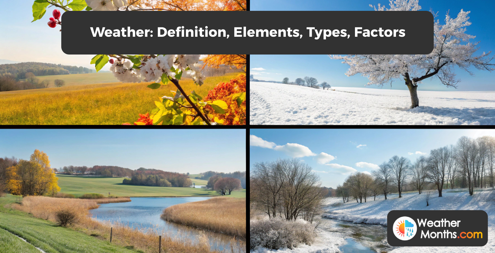
Monthly Weather Reports Around the Globe

Monthly weather in popular cities.

  • New York
  • Melbourne
  • Seattle
  • Austin
  • Denver
  • Houston
  • Dallas
  • Las Vegas
  • Miami

What is weather temperature?

Temperature in weather refers to the degree of hotness or coldness of the atmosphere, which is measured in Celcius (°C) or Fahrenheit (°F). It defines the thermal state of the atmosphere and influences its density, pressure, and moisture content. Variations in temperature drive atmospheric circulation, causing the formation of high and low-pressure systems, winds, and weather fronts. The interaction of air masses with different temperatures leads to the development of various weather conditions, such as storms, precipitation, and changes in wind patterns.
Monitoring and understanding temperature patterns and changes are essential for weather forecasting and the assessment of climate conditions. Meteorologists and climatologists analyze temperature data to track seasonal and long-term climate variations, identify temperature anomalies, and provide forecasts and assessments related to temperature trends and their implications for the environment and society. Temperature plays a significant role in influencing weather phenomena and atmospheric processes.

What is maximum weather temperature?

The maximum weather temperature is the highest temperature recorded in a specific weather system or region. It is important because it provides valuable insights into temperature extremes and helps meteorologists track heatwaves and other significant weather events. By monitoring the maximum weather temperature, meteorologists can issue warnings and advisories to help people prepare for extreme heat or take necessary precautions to stay safe.
The maximum weather temperature is also crucial for various sectors, including agriculture, energy, and public health. Farmers use temperature data to determine the best time for planting and harvesting, while energy companies analyze temperature trends to forecast electricity demand. Public health officials also rely on maximum weather temperature data to develop strategies to protect vulnerable populations from extreme heat.
Additionally, tracking the maximum weather temperature helps researchers and policymakers assess the impacts of climate change and develop strategies to mitigate its effects. By analyzing temperature data over time, they can identify trends and patterns that indicate changes in the climate and make informed decisions to address these issues.

What is minimum weather temperature?

Minimum weather temperature, also known as the minimum temperature, is the lowest temperature recorded or forecasted for a specific location during a given time, typically overnight or during a 24-hour period. It represents the coldest point in the temperature cycle and is a crucial parameter in understanding weather conditions.
The minimum temperature is significant for several reasons. First, it affects living organisms, including humans, animals, and plants, as they must adapt to and survive these colder conditions. For example, the minimum temperature in the troposphere that affects weather can be as low as -184°F (-120°C), and human activities such as greenhouse gas emissions, deforestation, urbanization, and industrial activities can significantly impact this temperature.
Second, from a scientific perspective, the minimum temperature helps define the temperature range for a specific climate or microclimate. For instance, the average temperature range in the mesosphere is -2.5 to -90 degrees Celsius.
Finally, from a practical standpoint, the minimum temperature helps individuals and industries plan for and mitigate potential risks associated with extreme cold, such as freezing pipes, agricultural frost damage, or dangerous travel conditions. Satellites play a vital role in monitoring minimum weather temperatures by providing real-time data for weather prediction models, enhancing weather forecasting, disaster management, and climate resilience.

What is feels like weather temperature?

The “feels like” weather temperature is a measurement that takes into account the perceived temperature based on factors such as wind speed and humidity, in addition to the actual air temperature. It provides a more accurate indication of how the weather conditions will feel to individuals.
The “feels like” temperature is determined by the combination of the actual air temperature, the level of relative humidity, and the impact of wind speed on the skin. In hot and humid conditions, the “feels like” temperature is higher than the actual temperature because the body has a harder time cooling down through sweat evaporation. In cold and windy conditions, the “feels like” temperature is lower than the actual temperature because the wind removes heat from the body more quickly.
The term “feels like” temperature is often used in weather forecasts and is a useful indicator for people planning outdoor activities. For example, if the actual temperature is 25°C but the “feels like” temperature is 30°C due to high humidity, it may be necessary to take extra precautions to stay cool and hydrated.

What is precipitation in weather?

Precipitation in weather refers to any product of the condensation of atmospheric water vapor that falls from clouds due to gravitational pull. It is a fundamental meteorological phenomenon that has a significant impact on the Earth's climate system and various aspects of human life and natural ecosystems.
Precipitation encompasses a wide range of water and ice forms, including rain, drizzle, snow, sleet, ice pellets, graupel, and hail. It is the process by which the atmosphere releases the moisture it holds, providing essential water resources for the planet's surface. The type and intensity of precipitation are key elements of weather forecasting and climate monitoring, as they reflect the dynamics and thermodynamics of the atmosphere.

What is precipitation chance in weather?

The chance of precipitation in weather forecasting refers to the probability or likelihood of measurable precipitation occurring in a specific area during a certain time period, such as a day, hour, or week. The precipitation chance in weather indicates the likelihood that any location within a forecast area will experience some form of precipitation, such as rain, snow, sleet, or hail. Meteorologists and weather forecasters use sophisticated models and data analysis to assign a probability value to precipitation, taking into account various atmospheric factors and their uncertainties. Understanding the chance of precipitation helps individuals and communities make informed decisions and take appropriate actions. It assists in planning outdoor activities, scheduling events, determining irrigation needs, and preparing for potential weather impacts.

What is precipitation cover?

Precipitation coverage is the percentage of an area that experiences some form of precipitation (rain, snow, sleet, etc.) during a specific time interval. It provides a measure of the spatial extent of the precipitation event and indicates how widely scattered or localized the precipitation is. High precipitation coverage suggests that the precipitation event is widespread and affecting a large area, while low precipitation coverage indicates that the precipitation is more isolated and only impacting a small portion of the region. Meteorologists and climatologists use precipitation coverage to assess the overall impact of a weather system and to track its movement and evolution. It also helps in understanding its implications for various sectors such as agriculture, transportation, and energy. Precipitation coverage is a metric that tells us the percentage of time during the reporting window that the precipitation actually occurred. Wind patterns play a crucial role in determining precipitation coverage by controlling the movement of air masses and moisture in the atmosphere, which can result in variations in rainfall distribution. The average percentage of time that precipitation covers a specific area can range from 40% to varying percentages based on historical data and regional climate patterns.

What are the types of precipitation?

The five main types of precipitation are rain, snow, sleet, freezing rain, and hail.
Rain is the most common type of precipitation and is associated with warm weather systems. Snowflakes form in clouds as ice crystals that undergo complex processes of growth and development before falling to the ground as unique, six-sided ice crystals. Freezing rain creates a coating of ice, resulting in hazardous conditions for travel and infrastructure. Hailstones are formed through a process of repeated updrafts and downdrafts in thunderstorm clouds, allowing ice to grow around a nucleus before finally falling to the ground.

What is rain?

Rain is liquid precipitation that falls from the clouds and is a key component of the water cycle and plays a vital role in the distribution of water resources. It is characterized by the formation of water droplets that are large enough to fall under gravity and is a fundamental natural phenomenon with far-reaching impacts on the environment and human activities. These droplets are formed through the process of condensation and coalescence in the atmosphere. Rainfall can vary in intensity, duration, and the amount of water it delivers to the Earth's surface.

What is hail?

Hail is a form of solid precipitation that is distinct from ice pellets. It is composed of transparent or translucent ice layers called spherulites that are arranged around a central nucleus, giving hailstones a layered or onion-like appearance. Hailstones can range in size from small pebbles to large grapefruits.

What is snow?

Snow is a type of precipitation that falls from the sky in the form of small ice crystals. These crystals, known as snowflakes, are formed through a process of nucleation and accretion, where water vapor freezes around a nucleus and other water molecules attach to it. The size and shape of the snow particles are determined by various factors, including temperature, humidity, and atmospheric conditions. Snowflakes are usually branched and star-shaped, with six distinct points, although they can take on various shapes.
What is snow depth?
Snow depth is the vertical measurement of accumulated snow on the ground, typically expressed in inches or centimeters, representing the total height from the underlying surface to the top layer of the snowpack. Meteorologists and climatologists track snow depth as part of their monitoring and data collection efforts to understand and predict weather patterns, assess the severity of winter storms, and determine long-term climate trends. Hydrologists and water resource managers utilize snow depth measurements to estimate snow water equivalent (SWE), which is the amount of water stored in the snowpack. This information is crucial for forecasting spring runoff, managing reservoirs, and assessing drought conditions. Ecologists and biologists study the impacts of snow depth on plants and animals, especially in northern and alpine regions, where snow cover acts as an insulating layer influencing the timing of plant growth, availability of food for animals, and the ability of animals to move and survive. Winter sports enthusiasts monitor snow depth to determine the quality of snow conditions and the feasibility of engaging in their preferred activities. Resorts and recreational organizations often provide updates on snow depth to assist participants in making informed decisions.

What is wind?

Wind is the natural movement of air or other gases relative to a planet's surface. It is caused by differences in atmospheric pressure, mainly due to temperature differences. The primary driver of wind is the uneven heating of the Earth's surface by the sun, creating temperature and pressure gradients. Air moves from areas of higher pressure to areas of lower pressure, creating wind. The interaction of the Earth's rotation with air movements causes the wind to follow curved paths, known as the Coriolis effect. Wind is an essential component of atmospheric circulation systems and plays a crucial role in weather and climate patterns.

What is wind speed?

Wind speed is the rate at which air moves horizontally past a certain location. It is typically measured in meters per second (m/s), miles per hour (mph), or kilometers per hour (km/h), although the World Meteorological Organization (WMO) recommends meters per second (m/s) as the standard unit. The Beaufort scale is historically used to classify wind speeds based on visual observations of wind effects at sea or on land. Wind speeds can vary based on the height of measurement above the ground. Different units such as miles per hour (mph), knots (kn), and feet per second (ft/s) have been historically used to measure wind speeds. The wind speed is a fundamental parameter in meteorology, climatology, and atmospheric physics, as it influences weather patterns, atmospheric circulation, and the transport of energy and mass in the atmosphere.

What is wind gust?

A wind gust is a brief and sudden increase in wind speed that exceeds the background wind speed by at least 10 knots (18.5 km/h or 5.14 m/s) and reaches a speed of 20 knots (37 km/h or 10.3 m/s) or more. Wind gusts are characterized by their transient nature, often lasting less than 20 seconds, and are typically followed by a lull or decrease in wind speed. Gusts can be caused by various meteorological and topographical factors, including the interaction of different air masses, the presence of atmospheric instability, or the obstruction of airflow by natural or man-made structures. Gusty winds can have significant impacts on weather conditions and local environments, affecting temperature, visibility, and the behavior of precipitation. Strong gusts of wind can also have practical implications for aviation, maritime navigation, and land-based transportation, as they can create turbulence, reduce stability, and cause damage to vehicles and infrastructure.

What is wind direction?

Wind direction is the direction from which the wind is blowing. It is determined by the direction that the wind is coming from, not the direction it is going to. Wind direction is an essential element of meteorological data as it provides valuable information about weather patterns, air circulation, and temperature changes. It is commonly measured and reported in degrees or cardinal directions (north, south, east, west). Understanding wind direction is crucial in various fields, including meteorology, aviation, marine navigation, and environmental science.

What is visibility in weather?

Visibility in weather is the prevailing horizontal distance at which an object can be clearly discerned by a certified weather observer under current light and weather conditions. It is measured by the distance at which a human can make out individual elements of the atmosphere. Visibility is impacted by various types of obscuration like mist, fog, smoke, volcanic ash, dust, sand, and haze. Poor visibility can have significant impacts on aviation operations, leading to ground delays, flight diversions, cancellations, and extra operating costs. Visibility plays a critical role in transportation and aviation by impacting operations, safety, and efficiency.

What is cloud cover?

Cloud cover in weather refers to the extent to which the sky is covered by clouds at a given time and location, and is a fundamental aspect of atmospheric conditions that has implications for various weather phenomena. Meteorologists and weather scientists assess and report cloud cover to track weather patterns and make forecasts. Cloud cover is measured in terms of its percentage, ranging from 0% (clear sky) to 100% (completely overcast), and can also be qualitatively described using terms like "partly cloudy," "mostly cloudy," or "broken clouds."

What is humidity in weather?

Humidity is the amount of water vapor in the air. It is an essential atmospheric parameter that influences weather patterns and conditions. Understanding humidity in weather encompasses not only its quantity but also its characteristics relative to temperature.
Meteorologists and weather scientists commonly use two types of humidity definitions: absolute humidity and relative humidity. Absolute humidity refers to the actual amount of water vapor in the air, often measured in grams per cubic meter or grains per cubic foot. Relative humidity (RH), on the other hand, expresses the percentage of moisture in the air compared to the maximum amount it can hold at a given temperature. Relative humidity is derived from the actual water vapor quantity and the air temperature. It is a critical indicator of how close the air is to saturation and is often used in weather analysis and forecasting. Another important humidity definition in weather is dew point. Dew point is the temperature at which air becomes saturated, and water condenses into dew or fog. Dew point temperature is an absolute measure of humidity and is used to describe how muggy and humid it feels outside, especially when comparing actual air temperature to dew point temperature.

What is pressure in weather?

In meteorology, pressure is the force exerted by the atmosphere per unit area, typically measured in hectopascals (hPa) or millibars. Atmospheric pressure is crucial in weather systems as it drives the movement of air masses and influences the formation of various weather features, such as wind, clouds, and storms.
The definition of pressure in weather encompasses not only the magnitude of atmospheric force but also the concept of pressure systems, which are areas with relatively high or low pressure. These pressure systems play a fundamental role in meteorology, as they dictate the behavior of the atmosphere and are closely associated with different weather conditions.
Understanding atmospheric pressure is essential for meteorologists and weather enthusiasts as it provides insights into the dynamics of the atmosphere and helps in predicting and interpreting weather patterns.

What is UV Index in weather?

The UV Index is a number on a scale from 1-11+ that tells you how intense the UV rays from the sun are predicted to be at a particular time and place. The UV Index is calculated based on factors such as the thickness of the ozone layer, cloud cover, time of year, and elevation of the city. The UV Index helps individuals know how much UV radiation will reach them if they go outside, allowing them to take appropriate precautions. Too much UV light can burn the skin in the short term and raise the risk for skin cancer in the long term. The UV Index is designed to help people effectively protect themselves from UV radiation, which can cause sunburn, skin aging, DNA damage, skin cancer, immunosuppression, and eye damage. The UV Index is a color-coded scale that categorizes UV ray exposure levels into low, moderate, high, very high, and extreme exposure categories.

What is solar radiation in weather?

Solar radiation in weather refers to the energy emitted by the sun that reaches the Earth's atmosphere and surface. It encompasses the entire electromagnetic spectrum, including visible light, ultraviolet, and infrared wavelengths. Solar radiation is a crucial component of weather and climate systems, driving atmospheric circulation, the water cycle, and the formation of weather phenomena. The amount and distribution of solar radiation influence temperature patterns, wind dynamics, and the intensity of the hydrological cycle. Meteorologists and climatologists study solar radiation to understand its variations and interactions with the atmosphere for weather forecasting, climate change assessment, and renewable energy development.

What is solar energy in weather?

Solar energy in weather refers to the use of sunlight as an energy source for weather-related processes and the study of how weather conditions impact the use and efficiency of solar energy. It encompasses two main aspects: the harnessing of solar energy for weather applications, and the understanding of how weather factors affect solar energy systems.
Solar energy is crucial for various weather phenomena, including the formation of clouds, air circulation, and the water cycle. It is utilized in weather forecasting and monitoring through the use of satellites and instruments that measure solar radiation. Additionally, solar energy is a key focus as a renewable energy source to mitigate climate change and reduce reliance on fossil fuels.
The impact of weather on solar energy involves studying how weather conditions, such as cloud cover, temperature, and wind, can affect the efficiency and output of solar energy systems. This understanding helps in optimizing the use of solar energy and developing technologies that can withstand and adapt to different weather factors.

What is a severe weather risk?

Severe weather risk refers to the potential danger and adverse effects that severe weather conditions, such as thunderstorms, tornadoes, hurricanes, and blizzards, can pose to individuals, communities, and the environment. It involves the assessment and prediction of the likelihood and severity of hazardous weather events that can result in significant damage, disruption, and loss of life.
The potential impacts of severe weather risk on communities and individuals include damage, social disruption, and loss of human life. The different types of severe weather that pose a risk to people and property include high winds, hail, excessive precipitation, wildfires, thunderstorms, downbursts, tornadoes, waterspouts, tropical cyclones, extratropical cyclones, blizzards, ice storms, and duststorms. The factors that contribute to the intensity of severe weather risks include temperature or moisture boundaries, moisture, and atmospheric instability.
The concept of severe weather risk is rooted in the understanding that weather-related phenomena have the potential to cause harm and that proactive measures, including forecasting, monitoring, and warning systems, as well as individual and community preparedness, are essential to mitigate these risks.
Severe weather risks are evaluated based on factors such as the likelihood of occurrence, the intensity of the event, and the vulnerability of the affected population or area. This assessment helps in the development of strategies and systems to minimize the impact of severe weather events and to respond effectively when they occur.
The main components of warning and forecasting systems for severe weather risk include detection, monitoring, and forecasting hazards; analyses of risks involved; dissemination of timely warnings; and activation of emergency plans. Severe weather can lead to health risks, economic losses, displacement, and food insecurity, with vulnerable populations being disproportionately affected.