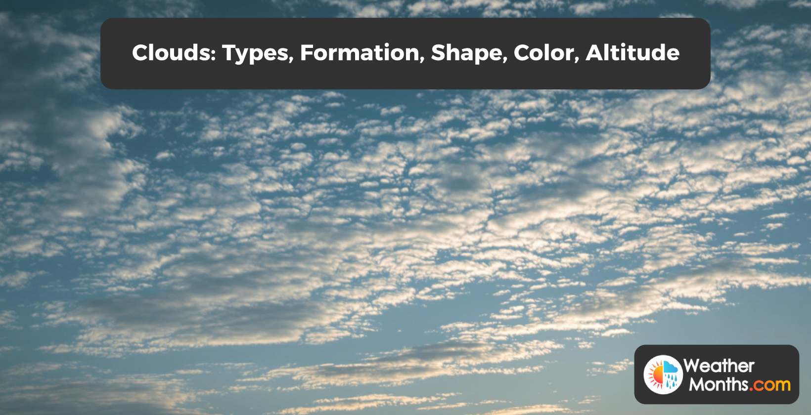
Clouds are masses of water droplets or ice crystals suspended in the atmosphere. Clouds have types, formations, shapes, colors, and altitudes. Clouds play a crucial role in Earth’s weather patterns and climate regulation. Clouds affect temperature, precipitation, and atmospheric conditions. Learn about clouds’ classifications, formation processes, shapes, color variations, and altitudes.
Types of clouds exist in the atmosphere. Cirrus clouds are high-level ice crystals, cumulus clouds have flat bases, and stratus clouds are uniform and flat.
Cloudy weather occurs due to specific atmospheric conditions. Warm air rises, cools, and reaches saturation, leading to cloud formation. Cold fronts meeting warm air masses create conditions for clouds. Cloud formation occurs at temperatures between 0-10°C (32-50 °F) with humidity levels above 80%.
Cloud height varies depending on the type of cloud. Clouds, such as stratus, have a base around 6,500 feet (2 km). Mid-level clouds, including altocumulus and altostratus, have bases between 6,500-20,000 feet (2-6 km (1.243-3.728 miles)). High clouds, like cirrus, cirrostratus, and cirrocumulus, have bases from 20,000-40,000 feet (6-12 km (3.728-7.456 miles)). Cumulonimbus clouds extend to heights of 50,000 feet (15,200 meters).
Cloud movement is influenced by factors in the atmosphere. Wind governs cloud movement across the sky, with winds carrying clouds higher. Jet streams transport clouds over distances.
What is the definition of a cloud in weather?
Clouds are aggregates of minute water droplets or ice crystals suspended in the atmosphere. Atmospheric scientists define clouds as masses formed by water vapor condensation onto particles. Clouds regulate Earth’s temperature and precipitation patterns. Various cloud types exist at altitudes, including cumulus, stratus, and cirrus. Cloud characteristics depend on temperature, humidity, and condensation nuclei.
Clouds form when air reaches its dew point temperature. Water vapor condenses to form clouds when air cools. Clouds grow as more water vapor condenses onto existing droplets. Clouds indicate weather conditions to meteorologists. Cumulus clouds indicate fair weather, while stratus clouds indicate overcast conditions. Clouds define weather and climate patterns in regions. Meteorologists arrange clouds into low, middle, and high layers for classification purposes.
What are the different types of clouds?
Cloud types appear diverse in their variety. Luke Howard classified clouds into three basic categories: cirrus, cumulus, and stratus. Cirrus clouds are high-level ice crystals. Cumulus clouds are puffy with flat bases. Stratus clouds are uniform and flat. Cloud types include cirrostratus, cirrocumulus, stratocumulus, congestus, altocumulus, and nimbus. Clouds vary in shapes, sizes, and forms.
Mid-level clouds consist of altocumulus and altostratus. Altocumulus clouds appear as waves or ripples in the sky between 6,500 and 20,000 feet. Altostratus clouds form a uniform gray or blue layer at altitudes, preceding precipitation.
Low-level clouds comprise cumulus, stratus, and stratocumulus. Cumulus clouds are white clouds with flat bases and rounded tops, forming below 6,500 feet. Stratus clouds create a layer close to the ground. Stratocumulus clouds appear as a series of masses in the sky.
Vertical clouds include nimbus and cumulonimbus. Nimbus clouds are rain-bearing clouds that produce continuous precipitation. Cumulonimbus clouds are towering clouds extending from low altitudes to heights above 10,000 feet, associated with thunderstorms and severe weather.
Mammatus clouds have pouch-like protrusions hanging from their base. Anvil clouds feature an anvil-shaped top spreading outward from a cumulonimbus cloud. Shelf clouds display a shelf-like base preceding a thunderstorm. Funnel clouds form a funnel-shaped column extending from the cloud base towards the ground.
How many cloud types are there?
Cloud classification recognizes 10 basic types. Luke Howard’s 1802 system grouped clouds into three main categories: cumulus, stratus, and cirrus. Clouds are categorized into three levels based on altitude: low, medium, and high. Four genera categorize clouds: cirrus, cumulus, stratus, and nimbus.
Meteorologists classify 100 different cloud types based on factors like shape, transparency, and arrangement. Low clouds form below 6,500 feet and include stratus, stratocumulus, and nimbostratus. Medium clouds form between 6,500 and 20,000 feet and include altocumulus and altostratus. High clouds form above 20,000 feet and include three types: cirrus, cirrostratus, and cirrocumulus.
What is cloud cover in weather?
Cloud cover measures the fraction of sky obscured by clouds. Meteorologists quantify cloud cover in oktas, ranging from 0 (clear) to 8 (overcast). Classifications include clear (0-2 oktas), partly cloudy (3-5 oktas), cloudy (6-7 oktas), and overcast (8 oktas). Cloud cover percentage spans 0-100%. Seven cloud layers exist based on altitude. Global average cloud cover is 60-70%.
Satellites play a role in measuring cloud cover. Geostationary and polar-orbiting satellites use visible and infrared sensors to detect cloud cover with high spatial and temporal resolution. Doppler radar systems detect clouds and estimate cloud cover. Weather observers estimate cloud cover by observing the sky.
Meteorologists generate cloud cover forecasts using numerical weather prediction models. National meteorological agencies issue cloud cover forecasts. Industries like aviation, agriculture, and energy rely on cloud cover forecasts for their operations. Cloud cover maps represent cloud cover distribution.
Cloud cover impacts precipitation, temperature, and visibility. Extensive cloud cover increases the likelihood of rain or snow. Cloud cover reduces visibility, making navigation and outdoor activities difficult. Cloud cover influences temperature, with more cloud cover leading to cooler daytime temperatures.
Cloud cover coverage is described as scattered, broken, or overcast. Meteorologists analyze cloud cover, types, heights, and patterns to predict weather systems and conditions.
How can clouds help predict the weather?
Clouds provide hints about changing weather patterns. Fair weather is indicated by cumulus and wispy cirrus clouds. Precipitation is signaled by dense clouds like stratus and nimbus. Cloud height and type reveal approaching weather systems. Low-level clouds indicate warm fronts. High-level clouds signal cold fronts. Meteorologists analyze cloud characteristics to make weather predictions.
Cloud shapes, altitude, density, and color are important factors in predicting the weather. Cirrus and cirrostratus clouds indicate fair weather. Stratus and stratocumulus clouds signal overcast conditions. Thick dense clouds indicate precipitation. Thin wispy clouds suggest fair weather. Dark gray clouds indicate heavy precipitation or thunderstorms. White puffy clouds signal fair weather. Towering cumulus clouds indicate instability leading to thunderstorms or heavy precipitation.
Clouds affect weather in ways. Clouds regulate temperature by trapping heat through the greenhouse effect. Clouds shade the Earth’s surface by blocking sunlight. Clouds warm the Earth’s surface by trapping heat at night. High-level clouds cool the Earth’s surface by reflecting sunlight into space. Clouds reflect sunlight to reduce solar radiation reaching the ground.
Cloud observation allows forecasters to predict weather patterns. Clouds indicate likelihood of precipitation like rain or snow. Clouds signal changes in wind patterns such as approaching low-pressure systems. Clouds indicate changes in atmospheric pressure leading to weather changes. Clouds reveal changes in humidity like approaching air masses. Clouds signal changes in air movement such as approaching weather fronts.
Clouds play a role in weather forecasting. Water vapor in the air condenses onto particles to form clouds. Cloud shapes, altitude, density, and color reveal details about the weather. Cloud altitude ranges from 6,500 feet to 40,000 feet. Cloud density ranges from 0.1 to 10 grams per cubic meter. Cloud color ranges from white to dark gray. Cloud movement ranges from 8 to 80 km (5 to 50 miles) per hour. Clouds produce precipitation rates up to 254 mm (10 inches) per hour. Some clouds produce precipitation rates over 25.4 mm (1 inch) per minute. Meteorologists analyze these characteristics to predict weather patterns and provide forecasts.
How do clouds affect temperature?
Clouds affect Earth’s temperature in complex ways. Clouds tend to cool the planet by reflecting sunlight, reducing solar radiation by up to 20%. Clouds warm Earth by trapping heat, increasing surface temperature up to 10°C (50°F). High clouds cool by reflecting sunlight. Low clouds warm by trapping heat. Thicker clouds act as insulating blankets.
Clouds trap heat in the atmosphere through mechanisms. High clouds tend to warm the planet by trapping more heat than they reflect sunlight. Clouds act like a blanket, insulating the Earth’s surface from temperature extremes. Clouds absorb and emit longwave infrared radiation, contributing to the greenhouse effect and warming the lower atmosphere.
Clouds influence climate by altering Earth’s energy balance. Clouds cover 60% of Earth’s surface, playing a role in regulating global temperature patterns. Clouds balance temperature through their combined cooling and warming effects, helping maintain temperatures on our planet. Clouds affect the temperature range, reducing daytime heating and nighttime cooling. Clouds top out at different altitudes in the atmosphere, with cloud types impacting temperature in different ways.
What causes cloudy weather?
Cloudy weather is caused by temperature, humidity, air pressure, and wind. Warm air rises, cools, and reaches saturation. Water vapor condenses on particles. Different cloud types include cumulus, stratus, and cirrus. Cloud formation occurs at 0-10°C with >80% humidity.
Air saturates with moisture as it cools, reaching the dew point temperature. Droplets form from condensed water vapor around particles in the atmosphere called condensation nuclei. Particles collect water droplets, which grow in size and become visible as clouds. Clouds develop when conditions allow, requiring 1-2 grams of moisture per cubic meter of air. Cloud cover of 80% or higher characterizes weather accompanied by precipitation.
Mountains and hills force air to rise, creating clouds through orographic lifting. Low-pressure systems contribute to cloud formation by causing air to rise and cool. Wind direction and speed influence cloud development, affecting the distribution of moisture and temperature patterns. Location and season impact the conditions for cloud formation, with varying dew point temperatures ranging from 10-20°C (50-68°F).
What clouds form in a warm front?
Warm fronts form high-level cirrus clouds consisting of ice crystals. Cirrostratus clouds create a ring of light around the sun or moon. Altostratus clouds develop, covering the sky and producing light to moderate precipitation. Layered clouds thicken and lower as warm fronts approach.
Mid-level clouds mark the warm front’s leading edge. Altocumulus clouds form in waves or ripples, while altostratus clouds create uniform gray layers. Cloud bases lower to below 6,500 feet as the warm front approaches. Clouds become denser and opaque during the warm front’s progression.
Low-level clouds indicate the warm front’s arrival. Stratus clouds produce drizzle, while nimbostratus clouds generate precipitation. Cumulonimbus clouds rarely develop in unstable warm fronts. Cloud masses extend hundreds of miles in warm frontal systems. Cloud patterns follow a high, middle, and low-level progression influenced by the front’s strength and moisture content.
Why do clouds form over mountains?
Clouds form over mountains due to orographic lift. Air flows over mountain ranges, forcing it upward. Ascending air cools, causing moisture to condense. Sufficient moisture and strong mountain ranges generate clouds. Cooling air creates a cool environment for condensation. Mountains act as barriers, disrupting airflow and producing clouds in mountainous regions.
Moisture condensation occurs as the cooling air reaches its dew point. Dew point is 10-20°C (50-68°F) lower than the air temperature. Water vapor condenses into cloud droplets when the air becomes saturated. Condensed water vapor forms clouds over the mountain range.
Convection contributes to cloud formation over mountains. Sun heats mountain slopes, warming the air near the surface. Heated air expands and rises, creating upslope flow. Upslope flow triggers convection currents, driving air. Wind patterns further enhance upslope flow, leading to additional cloud formation.
How do rain clouds form?
Rain clouds form when water vapor in air condenses into liquid droplets. Condensation occurs as rising water vapor cools to its dew point. Particles like dust act as nuclei for droplet formation. Water droplets grow larger, creating clouds. Saturated clouds produce precipitation. Cloud formation process remains invisible until droplets become large enough to be seen.
Particles collect water vapor and act as condensation nuclei. Vapor clumps together around these particles to form water droplets. Clouds appear as droplets gather and grow in size. Clouds darken as larger droplets absorb more sunlight. Droplets grow through collision and coalescence with droplets. Air holds these growing droplets until they become heavy.
Droplets gather and combine to form larger raindrops. Rain falls when droplets reach 5 millimeters (0.2 inches) in diameter. Rain clouds are characterized by updrafts and downdrafts. Cumulonimbus clouds, the rain-producing clouds, reach heights over 10,000 meters. Rain clouds produce precipitation, accompanied by lightning and thunder.
How do clouds produce rain?
Clouds produce rain through condensation and droplet growth. Water vapor condenses on particles, forming visible droplets. Droplets collide and merge, growing larger. Updrafts suspend droplets, allowing growth. Heavy drops fall as rain when gravity overcomes updrafts. Raindrops reach 0.5 mm (0.2 inches) diameter and 1-2 mg weight before falling at 5-10 m/s.
Do all clouds produce rain?
Not all clouds produce rain. Clouds require conditions to precipitate. Cumulonimbus clouds produce rain, reaching heights over 10,000 meters. Cirrus and stratocumulus clouds rarely precipitate due to their composition. The National Oceanic and Atmospheric Administration (NOAA) reports 10% of clouds produce precipitation. Moisture, air movement, and pressure determine cloud precipitation potential.
The condensation process is essential for cloud formation and rainfall. Clouds form when water vapor in the atmosphere condenses onto particles called condensation nuclei. Water droplets or ice crystals suspended in the air make up clouds. Droplet size and growth are critical factors in rain production. Droplets become too heavy to remain suspended and fall as precipitation.
Cloud type impacts rainfall potential. Cirrus clouds, composed of ice crystals, do not produce rain. Cumulus clouds produce light precipitation but do not result in heavy rain. Stratus clouds produce light to moderate precipitation. Cumulonimbus clouds are associated with heavy rain, thunderstorms, and even tornadoes.
Rainfall production varies among cloud types. Cumulus clouds produce up to 100 mm (4 inches) of rainfall per hour. Thunderstorms generate up to 1,000 mm (39 inches) of rainfall per hour. Stratus clouds yield up to 10 mm (0.4 inches) of rainfall per hour. Cloud seeding is a technique used to enhance precipitation in clouds. Silver iodide or dry ice is introduced into clouds to stimulate rainfall in drought-stricken areas.
Can it rain with no clouds?
Rain occurs without clouds in phenomena like virga and sun showers. Raindrops fall from invisible high-altitude or cloud systems. Mist near the ground produces rain without clouds.
How high are clouds in the sky?
Cloud heights vary by type. Low clouds (stratus) base around 6,500 feet (2 km). Mid-level clouds (altocumulus, altostratus) base between 6,500-20,000 feet (2-6 km). High clouds (cirrus, cirrostratus, cirrocumulus) base from 20,000-40,000 feet (6-12 km). Heights fluctuate based on region and weather patterns.
High-level clouds exhibit altitude variations based on geographical location. Clouds in polar regions form at 20,000 feet (6,100 meters) above the ground. Tropical high-level clouds have bases reaching up to 40,000 feet (12,200 meters). Cumulonimbus clouds, known for their towering vertical development, extend to heights of 50,000 feet (15,200 meters). The highest possible cloud formations occur at an altitude of 264,000 feet (50 miles or 80 kilometers) above the Earth’s surface.
Cloud bases mark the lowest point of cloud formation, while cloud tops indicate the highest altitude reached by these atmospheric phenomena. Meteorologists study cloud range and characteristics to understand weather patterns and climate systems.
What keeps clouds in the sky?
Clouds remain aloft through a balance of forces. Air pressure and buoyancy counteract gravity’s pull. Tiny water droplets or ice crystals suspended in less dense air form clouds. Rising air drives cloud formation through cooling and condensation. Wind patterns shape cloud movement. Clouds’ ability to stay suspended depends on their density relative to surrounding air.
Water vapor condensation is essential for cloud formation and suspension. Water droplets form around microscopic particles in the air, measuring between 0.01 and 5 millimeters in diameter. Droplets float in the air due to their small size and the constant motion of air molecules.
The balance between gravity and air resistance keeps clouds suspended. Density differences between the cloud and surrounding air create a buoyant force. Upward forces counteract the downward pull of gravity on the cloud droplets. Clouds stay suspended as long as the upward force equals or exceeds their weight.
Clouds appear to float across the sky due to these interactions. A cumulus cloud weighs 1-2 million pounds, while thunderstorm clouds weigh up to 100 million pounds. Clouds fall when air currents weaken or droplets become heavy enough to no longer remain suspended.
What makes the clouds move?
Wind governs cloud movement across the sky. Strong winds carry clouds faster and higher. Wind strength and speed influence cloud motion. Jet streams transport clouds. Coriolis force deflects cloud paths. Updrafts and downdrafts cause vertical cloud motion. Air pressure differences create wind, driving cloud movement. Clouds float in winds.
Differential horizontal motion creates cloud deformation and displacement, causing clouds to move at varying velocities at different altitudes. Turbulence in the atmosphere contributes to cloud movement by breaking or merging cloud formations, altering their trajectories. Heating and cooling of air masses influence cloud formation and motion, with convection currents driving clouds to create towering cumulus or thunderstorms. Orographic lifting forces clouds to rise and move over terrain, leading to cloud formation and reshaping as they pass over elevated areas.
Clouds appear to move across the sky due to the formation and dissipation of cloud bodies. Clouds are collections of water droplets or ice crystals suspended in the air, changing shape, size, and position. Cloud bodies move as a result of winds and air currents in the atmosphere, forming when air is cooled to its dew point.
Are clouds always moving?
Clouds are in motion, driven by winds reaching speeds up to 100 km/h (62 mph). Even clouds that appear stationary are moving. Clouds change shape and position. Stillness is not the usual state for clouds. Wind is the primary force behind cloud movement.
Atmospheric circulation patterns influence cloud motion. Earth’s rotation generates the Coriolis force, deflecting moving clouds to the right in the Northern Hemisphere and to the left in the Southern Hemisphere. Cloud movement speeds range from 0-80 km/h (0-50 mph), with wind speeds reaching up to 161 kph (100 mph) at altitudes.
Clouds exhibit both horizontal and vertical motion. Horizontal movement occurs as clouds ride prevailing winds at their altitude, with speeds ranging from 1-50 m/s in the troposphere. Vertical movement results from convection and instability, causing clouds to grow or dissipate. Internal circulation within cloud structures contributes to their flux, with water droplets and ice crystals changing and moving with wind flow.
How fast do clouds move?
Clouds move at varying speeds depending on their altitude and wind conditions. Low-level clouds move at 48 km/h (30 miles per hour). Mid-level clouds reach speeds up to 64 km/h (40 miles per hour). High-level clouds travel at speeds exceeding 161 km/h (100 miles per hour). Wind patterns influence cloud movement. Cloud speed helps predict weather systems and precipitation distribution.
Cloud movement is driven by weather patterns and wind currents. Wind direction, speed, and temperature influence cloud movement . Topography affects wind patterns and cloud behavior in regions. Clouds travel distances across continents and oceans, playing a crucial role in shaping climate and weather patterns. Cloud seeding introduces substances into clouds to enhance precipitation and affects cloud movement. Researchers study cloud seeding to understand its effects on cloud behavior and speed.
What do clouds look like?
Clouds appear in various forms across the sky. Puffy white cumulus clouds resemble cotton balls. Stratus clouds form gray or white layers covering the sky. Thin cirrus clouds streak high altitudes. Cumulonimbus clouds grow up to 18,000 meters tall with dark, anvil-shaped bases. Clouds vary in size, shape, and appearance.
Clouds exhibit characteristics in shape, texture, and color. Cumulonimbus clouds form tall, towering structures reaching heights over 10,000 meters. Stratocumulus clouds look like cauliflower with shapes. Nimbus clouds appear as rain-bearing masses in the sky. Clouds are composed of ice crystals or water droplets reflecting sunlight. Gray clouds indicate thickness and density, signaling overcast skies or impending rain. Cumulonimbus clouds are associated with severe thunderstorms or heavy rainfall.
Clouds form patterns and formations in the sky. Lenticular clouds have a lens or saucer-shaped appearance. Cirrocumulus clouds form rounded masses or parallel bands. Cloud iridescence creates a glow due to diffraction of sunlight through water droplets or ice crystals. Clouds appear wavy when influenced by wind currents or weather systems.
What do storm clouds look like?
Storm clouds exhibit a dark appearance with flat bases and rounded upper levels. Mothership clouds, or supercells, feature rotating updrafts reaching 10,000-18,000 meters high. Supercell storm clouds display anvil shapes and tints. Storm clouds have sculpted structures signaling severe weather, with cauliflower protrusions in upper regions.
Storm clouds exhibit features that set them apart from other cloud types. Pouch protrusions called mammatus clouds hang from the base, signaling turbulent air within the cloud. The base of storm clouds appears dark due to the amount of water droplets and water content. Storm clouds present an appearance with their layered structure and dramatic vertical development.
Cumulonimbus clouds are a common type of storm clouds. These clouds reach heights over 18,000 meters and are associated with thunderstorms. Cumulonimbus clouds produce heavy precipitation, including rain and hail. Thunder and lightning are generated by these cloud formations.
The name “cumulonimbus” reflects the cloud’s appearance. It comes from the Latin words “cumulus” meaning heap and “nimbus” meaning rain cloud.
What do snow clouds look like?
Nimbostratus clouds dominate snow cloud formations. Thick, dark gray or gray layers cover the sky. Snow clouds possess uniform bases below 2,000 meters. Anvil-shaped upper surfaces extend several kilometers thick. White or grey hues appear during snowfall. Nimbostratus clouds contrast with fluffy cumulus formations.
Snow clouds fade objects from view, obscuring landscapes and landmarks. They grow during intensifying storms, expanding both vertically and horizontally. Snow clouds cover large geographic areas, spanning hundreds of kilometers. These clouds reflect limited light, giving them a dark appearance.
Snow clouds are composed of ice crystals and supercooled water droplets. They are arranged in layered formations, reaching heights up to 10,000 meters with thicknesses of 1,000 meters. Snow clouds contain up to 10 grams of water per cubic meter and up to 100,000 ice crystals per liter. Snow clouds signal approaching snowfall and winter storms. They stock moisture and energy for snowstorms, capable of producing snowfall rates up to 10 centimeters per hour.
What do hurricane clouds look like?
Hurricane clouds look like an organized system of storm clouds. The cloud formation spans hundreds of miles in diameter, dwarfing storm clouds. A distinctive circular shape with an eye at the center characterizes the hurricane structure. The eye measures 20-40 km (12-25 miles) in diameter and appears as a calm area surrounded by intense storm activity.
Approaching hurricanes are visible from distances as swirling masses of clouds. The eyewall forms a ring of towering cumulonimbus clouds around the eye, 10-20 km (6-12 miles) wide. Spiral bands of clouds extend outward from the center, reaching up to 500 km (310 miles) from the storm’s core. Cloud tops soar to altitudes over 15 km (49,000 ft), creating an imposing wall-like appearance on the horizon.
Below the main hurricane system, observers see clouds with anvil-shaped bases. The cloud base hovers at 1-2 km (0.6-1.2 miles) altitude. Storm clouds fill the sky, taking on a greenish tint due to heavy precipitation. Individual cloud types like stratocumulus and cirrostratus are in the outer rain bands. The cloud structure blocks most sunlight, casting a gloom over the surrounding area.
What do rain clouds look like?
Rain clouds, known as nimbostratus clouds, appear as a gray blot across the sky. Nimbostratus clouds form layers covering the sky, blocking sunlight.
Warm, moist air rises into the atmosphere and cools, condensing into visible liquid droplets. Water vapor fills air spaces as the air rises, creating a layer of cloud cover that stretches for thousands of kilometers. Rain clouds blot out sunlight, casting shadows on the ground below and giving the sky a grayish appearance.
The appearance of rain clouds depends on the amount of water droplets or ice crystals they contain. Dense clouds with droplets look light gray or white. Rain clouds exhibit a greenish or bluish tint due to the scattering of sunlight by water droplets.
Rain falls from these clouds when water droplets become too heavy to remain suspended. Clouds fade as precipitation occurs, allowing sunlight to break through. Snow falls instead of rain in climates when air temperatures are below freezing. Water droplets in the cloud freeze into ice crystals and fall to the ground as snow.
Types of rain clouds exist, each with characteristics. Cumulonimbus clouds are dense clouds reaching heights over 10,000 meters, associated with heavy rain and thunderstorms. Nimbostratus clouds are clouds producing continuous, light to moderate precipitation. Cumulus clouds are white clouds that grow into towering cumulonimbus clouds.
Rain clouds are called precipitation clouds or water clouds. These clouds play a role in Earth’s water cycle, providing precipitation for life on our planet. Rain clouds look imposing, with towering vertical growth and anvil-shaped bases. Names for rain clouds include thunderheads, rain-bearing clouds, and water clouds.
What does a tornado cloud look like?
Tornado clouds appear as rotating, towering columns of clouds. Funnel clouds extend from thunderstorm bases toward the ground. Funnel clouds look like rotating columns hanging or dangling from storm clouds. Funnel clouds have greenish or yellowish-brown colors. Funnel clouds possess cylindrical or rope-like shapes with rounded or pointed tips.
Funnel clouds form as rotating columns of air descend from the storm base. The condensation funnel becomes visible as water vapor condenses in the rotating air column. Funnel clouds taper from a base at the storm to a narrow point near the ground.
Wall clouds or lowering clouds precede funnel cloud formation. The wall cloud appears as a mass at the thunderstorm base. Lowering clouds extend downward from the storm, developing into funnel clouds.
Tornado clouds rotate horizontally around a vertical axis at speeds up to 320 kilometers per hour (199 mph). The rotation pulls surrounding clouds upward, creating a distinctive anvil shape at the storm top. Debris clouds form at the funnel base when it contacts the ground, signaling tornado touchdown.
Tornado clouds are part of thunderstorm systems. These storms cover areas up to 1,000 square kilometers and reach heights over 15,000 meters. The “tornado cloud look” includes the rotating funnel, wall cloud, and surrounding cloud structures.
What do thunder clouds look like?
Thunder clouds, or cumulonimbus clouds, feature dark, flat bases hanging low in the sky. Towering vertical structures reach heights over 10,000 meters. Anvil-shaped tops contrast with cauliflower-like bases. Coloration ranges from deep blues and purples to greens and grays. Lightning and hail accompany these massive cloud formations.
Cumulonimbus clouds exhibit a towering vertical structure with a flat base and rounded upper portion. The top of these clouds looks cauliflower-like, forming a dome-like shape. Mature cumulonimbus clouds develop an anvil shape, identifiable from a distance. Thunderstorms sometimes produce a funnel-shaped extension called a mesocyclone, which leads to tornado formation.
Thunder clouds demonstrate rapid vertical development, growing at rates of kilometers per hour. Vertical growth rates reach up to 10 meters per second (36 feet per second), creating a spectacle. The diameter of thunderheads measures up to 10 kilometers (6.2 miles), while wind speeds within the storm reach up to 100 kilometers per hour (62 miles per hour).
Cumulonimbus clouds are associated with severe weather phenomena. These dark-based storm clouds produce rain, hail, thunder, and lightning during thunderstorms.
What kind of clouds look like waves?
Kelvin-Helmholtz clouds look like waves. Kelvin-Helmholtz clouds exhibit breaking wave-like shapes with wavy appearances. Kelvin-Helmholtz clouds resemble ocean waves, forming wavelike patterns with troughs and crests. These clouds appear in mountain lees at 2,000-10,000 meters altitude. Kelvin-Helmholtz clouds are capped clouds characterized by strong wind shear between air layers.
Asperitas formations exhibit a wave-like pattern. These clouds have an undulating underside that resembles a roughened sea surface. Asperitas clouds are a new cloud type, officially recognized in 2017. They appear in conjunction with or following thunderstorms.
Wave clouds, known as billow clouds, display an undulating pattern across the sky. These clouds form when winds create waves, at altitudes between 2,000 and 5,000 meters. Wave clouds occur in various cloud types, including cirrus, cirrocumulus, and altostratus.
Gravity waves in the atmosphere contribute to the formation of wave-like cloud patterns. These waves are created when stable air flows over rising terrain, causing the air to rise and sink. Gravity waves can reach heights of thousands of feet and travel distances through the atmosphere.
Cirrocumulus clouds form wave patterns at high altitudes. These rounded cloud masses are composed of ice crystals and appear in rows or ripples. Cirrocumulus clouds form at altitudes up to 6,000 meters and are associated with winds or gravity waves.
Why do clouds look flat on the bottom?
Clouds appear flat on the bottom due to the cloud base phenomenon. Warm air rises and cools as it ascends. Air at the cloud base altitude is cool enough for water vapor to condense into droplets. Droplets concentrate at this altitude, creating a uniform flat bottom. The condensation process occurs at this level.
Cloud formation begins at the LCL where air becomes saturated. Water vapor condenses onto particles in the air, such as dust, salt, and pollutants, which serve as condensation nuclei. Droplets grow and become as more water vapor condenses at this level. The temperature at the LCL ranges from 10°C to 20°C (50-68°F), depending on humidity and air pressure. Pressure at the LCL measures 900-950 mbar.
The flat bottom of clouds results from uniform cooling of air at the condensation level. Water vapor condenses into droplets at a consistent height, creating an anvil-shaped base. Ground observers see this flat cloud base as a bottom. The cloud continues to grow above the LCL as more air rises and cools. Cumulus and stratocumulus clouds exhibit these flat bottoms or anvil bases.
What does the inside of a cloud look like?
Clouds contain a mixture of water droplets, ice crystals, and water vapor. Water vapor condenses onto particles as air rises and cools. Droplets range from micrometers to millimeters in diameter. Ice crystals grow through accretion, reaching millimeters. Cloud interiors remain invisible due to the size of water particles.
Droplets scatter sunlight in all directions, giving clouds their characteristic white appearance. Tightly packed droplets create a defined cloud shape. Less dense areas of the cloud appear transparent. Denser regions look prominent in cumulonimbus clouds associated with thunderstorms.
The composition within a cloud changes in response to temperature, humidity, and wind variations. Higher altitude clouds contain ice crystals, while lower clouds are composed of liquid water droplets. Cumulus clouds have more updrafts and turbulence, resulting in larger water droplets and ice crystals inside.
What color are clouds?
Clouds appear white or light gray. Atmospheric conditions influence cloud colors. Sunlight scattering causes white appearance. Sunset creates red or orange hues. Cloud thickness affects perceived color. Cumulus clouds are white and puffy. Stratus clouds tend to be gray or blue-gray. Viewing angle impacts color perception.
Warm hues in clouds result from specific atmospheric conditions and time of day. Yellow-tinted clouds appear during sunset as shorter light wavelengths are scattered by the atmosphere. Hued clouds are visible during sunrise due to similar atmospheric light scattering. Red clouds occur when atmospheric particles like dust, smoke, or pollutants scatter light favoring longer wavelengths.
Cloud colors extend beyond white and gray shades. White clouds form when haze in the atmosphere scatters light. Pale blue-tinted clouds are visible on days due to atmospheric light scattering. Pink-hued clouds appear under certain atmospheric conditions, influenced by aerosols or pollutants scattering light favoring wavelengths. Cloud color depends on cloud type, formation conditions, time of day, and atmospheric phenomena such as fog, haze, or smoke.
What do orange clouds mean?
Orange clouds appear when sunlight interacts with dust and water vapor in the atmosphere. Sunlight reflects orange or red wavelengths back to observers. Cloud color results from Rayleigh scattering of light by particles. Orange hues indicate dust storms or atmospheric haze, signaling reduced air quality and visibility.
Pollution causes orange clouds by introducing light-scattering particles into the atmosphere. Nitrogen oxides from vehicles and industry concentrate in the air, contributing to orange cloud formation. Smoke from wildfires creates clouds by releasing soot, ash, and combustion products. Particles in smoke scatter and filter light, enhancing the orange coloration.
The atmosphere filters light differently during sunrise and sunset. Low sun position forces light to travel through more atmosphere at these times. Increased travel scatters blue and violet wavelengths, leaving red and orange wavelengths visible to observers. Studies have quantified pollution’s effect on cloud color. Researchers found high PM2.5 levels cause more frequent orange clouds in polluted areas.
What do green clouds mean?
Green clouds serve as a visual warning sign of severe weather. Water droplets and ice particles scatter light, creating a greenish glow. Hail and graupel illuminate clouds with colors. Storms producing green clouds bring rain, hailstones, or tornadoes. People must seek shelter immediately upon seeing green clouds.
Green clouds signify heavy hail and strong updrafts in the storm. Severe thunderstorms produce green clouds, warning of dangerous weather conditions. Green coloration does not directly indicate the presence of a tornado, but storms with green clouds generate hail, winds, and rain. Meteorologists study clouds to understand severe storm dynamics and use these observations to predict severe weather. People must take shelter when they observe green clouds in the sky due to the increased risk of destructive weather.
What do pink clouds mean?
Pink clouds result from light scattering in the atmosphere. Red and pink wavelengths remain as shorter wavelengths scatter. Cirrus clouds appear pink due to ice crystal interactions. Atmospheric conditions like pollution and humidity influence pink cloud formation. Pink hues indicate aerosol levels and atmospheric properties. Pink clouds range from light pastel to magenta coloration.
High pressure systems moving in create pink and red hues in the sky. Morning skies signal approaching storm systems or low pressure areas. Sunset amplifies colors, producing displays of pink clouds. Thin, high-level clouds take on a hue when the sun is between 10° and 20° above the horizon.
What do red clouds mean?
Orange-red clouds appear during sunrise and sunset. These colors indicate atmospheric conditions like dust, pollution, or water vapor. Light reflects off particles in clouds. Rayleigh scattering favors longer wavelengths. High-altitude cirrus and altocumulus clouds display hues. Red clouds signify sunsets and specific atmospheric compositions.
Orange-red clouds signal potential weather changes. Clouds filled with dust scatter more red light. Clouds filled with moisture appear redder due to increased light refraction. Water vapor affects cloud color and density, influencing the intensity of the red hue. Clouds thicken as moisture increases, leading to pronounced coloration. Sunlight diminishes as clouds become denser, altering the perceived color.
Weather implications vary depending on the time of day and atmospheric conditions. Red clouds in the morning indicate rain coming to an area within 12-24 hours. Red clouds in the evening signal a storm passing through or weather clearing up. The sun angle affects how light interacts with clouds, determining the intensity and duration of the red coloration. Dust affects the scattering of light by clouds, enhancing the red appearance in polluted or dusty environments.
What do yellow clouds mean?
Yellow clouds signal various atmospheric phenomena. Dust storms, air pollution, wildfires, and volcanic eruptions produce yellow tinted clouds. Approaching thunderstorms, tornadoes, and hurricanes manifest as yellow clouds on the horizon. Sunlight scattering through water droplets or ice crystals creates coloration. Cloud intensity and shade provide clues about underlying conditions and potential weather hazards.
Yellow clouds indicate tornadoes forming in severe weather situations. Weather experts associate yellow cloud formations with hail approaching in some storm systems. Forecasters warn yellow clouds signal a severe thunderstorm moving towards a region. Dust particles in the air contribute to the yellow coloration of clouds during these weather events. Yellow clouds are indicators of rain approaching in many meteorological occurrences.
Why are clouds grey?
Clouds appear gray due to sunlight interaction with water droplets or ice crystals. Cloud thickness determines color intensity. Thicker clouds block more sunlight, appearing grayer. Growing clouds reflect more light, appearing whiter. Thickness blocks sunlight, resulting in a gray appearance. Scattering effect makes clouds appear grayer than white, even in sunlight.
Cloud thickness and density play a role in their grey appearance. Clouds become opaque as they gather water droplets and ice crystals. Increased opacity leads to less sunlight passing through the cloud. Sunlight diminishes as it travels through clouds, resulting in a darker grey color. Clouds stop light from reaching observers when they become thick.
Light interaction with cloud particles contributes to the grey hue. Clouds absorb some of the sunlight, reducing the brightness. Water droplets scatter light more effectively than ice crystals, influencing the shade of grey. Ice crystals in high-altitude clouds tend to produce grey or white colors. Water molecules in clouds refract or bend sunlight, altering its path.
The effect of these factors determines the appearance of clouds. Less light reaches the observer’s eyes due to absorption, scattering, and refraction. Clouds appear grey or dark when viewed from below due to reduced light transmission. Cloud color varies from grey to black depending on thickness and composition.
Why do clouds look white?
Clouds appear white due to light scattering by water droplets. Water droplets in clouds act as particles, scattering sunlight in all directions. Scattered light reflects back to eyes, giving clouds a white appearance. Cloud droplets range from 0.01 to 5 millimeters in diameter. Larger droplets scatter light efficiently.
Mie scattering makes clouds look white. Cloud droplets act as efficient diffuse reflectors of the sun’s light. Droplets in clouds are larger than wavelengths of visible light, measuring 10-20 micrometers in diameter. Millions of droplets pack together in a cloud, with scattering coefficients on the order of 10^-6 to 10^-5 m^-1. Cloud albedo ranges from 0.5 to 0.9, depending on cloud type and particle size.
Particles scatter all wavelengths of visible light in all directions. Water droplets scatter all wavelengths with equal efficiency. Scattered light reflects back to eyes and combines colors of the spectrum. Eyes perceive this combined light as white. Clouds with large water droplets appear white. Water droplets in clouds reflect wavelengths of light not scattered. Specular reflection adds to cloud brightness and whiteness. Clouds combine scattered and reflected light to appear white. Non-uniform clouds scatter and reflect light to appear white.
What are the interesting facts about clouds?
Meteorology cloud aerosols consist of visible masses of liquid droplets or frozen crystals suspended in the atmosphere. Wind moves clouds, distributing heat and moisture. Clouds regulate climate by reflecting solar radiation and trapping heat.
The interesting facts about clouds are outlined below.
- Cloud formation: Evaporation and condensation processes lead to cloud creation as water vapor rises and cools.
- Cloud buoyancy: Clouds, though heavy, are spread across a vast space, allowing them to float.
- Cloud prevalence: At any moment, clouds cover 70% of Earth’s surface.
- Cloud classification: Scientists categorize clouds by shape, height, and characteristics.
- Cloud composition: Contains water droplets, ice crystals, pollutants, and bacteria.
- Cloud diversity: Clouds appear in different shapes, sizes, and colors, including white, gray, and black.
- Cloud altitudes: Range from a few hundred feet to over 33,000 feet high.
- Cloud types: Includes cumulus, stratus, cirrus, and nimbus varieties.
- Cloud weight: Cumulonimbus clouds can weigh up to 1 billion pounds.
- Cloud impact: Clouds affect climate by influencing temperature, precipitation, and weather patterns.
- Cloud research: Key to understanding Earth’s systems and climate.
- Cloud classification history: Luke Howard developed the classification system used since 1803.
- Rare clouds: Noctilucent clouds are formations that interest scientists and observers.
Are there clouds in the desert?
Deserts are not cloudless. Clouds exist in desert environments. Various cloud types form in regions, including cirrus, altocumulus, altostratus, stratus, and stratocumulus. High-level and low-level clouds appear in desert skies. Low-level clouds produce light to moderate precipitation in desert areas.
Clouds form over deserts under conditions. Humid air advection provides moisture for thunderstorm clouds. Desert dust particles act as nuclei for cirrus cloud formation. Coastal deserts experience cloud cover from nearby oceans. Orographic lifting forces air to rise and form clouds. Cloud seeding techniques introduce particles to induce cloud formation.
Desert atmospheres have low humidity and high temperatures. Limited atmospheric moisture contributes to the rarity of clouds in arid regions. Clouds are less frequent in deserts compared to temperate regions. Satellite data shows the Sahara Desert has 20-30% cloud cover, while temperate regions have over 50-60% cloud cover.
Temperature affects cloud formation in desert environments. Heat dissipates daytime clouds. Clouds form at night when air cools. Seasonal variations influence cloud presence, with clouds appearing during cooler months. Clouds regulate desert temperatures through shading and evapotranspiration, reducing soil temperature by up to 10°C (50°F) in some areas.
Desert clouds have lower water content than humid region clouds. Desert clouds form at altitudes above 2,000 meters. Desert clouds dissipate due to intense sunlight and dry air. Cloud types exist in desert regions, including cumulus, stratus, and altocumulus clouds.
Do clouds evaporate?
Clouds evaporate when temperatures increase. Heating causes liquid water droplets to change from liquid to gas. Evaporation rates reach 1-2 mm/hour (0.04-0.08 in/h), depending on air temperature and humidity. Dry air accelerates cloud evaporation. Warmer air holds more moisture than cooler air. Cloud evaporation releases heat into the atmosphere, regulating Earth’s climate.
Cloud evaporation occurs when water droplets or ice crystals transform back into water vapor. The process is driven by atmospheric conditions including temperature, air pressure, and wind patterns. Warm air temperatures increase the rate of evaporation, causing cloud particles to dissipate more quickly. Low air pressure and strong winds contribute to faster cloud evaporation by dispersing the water droplets.
The vapor and condensation cycle plays a role in cloud evaporation. Water vapor in the atmosphere condenses to form clouds, and cloud particles evaporate back into water vapor. This cycle maintains the balance of moisture in the atmosphere. Studies show that up to 50% of clouds evaporate within 1 hour of formation.
Cloud evaporation rates vary depending on environmental factors. Measurements indicate evaporation rates ranging from 0.1 to 10 mm (0.004-0.4 inches) per hour under various conditions. Temperature changes have an impact on cloud stability. A rise in air temperature accelerates the evaporation of cloud particles, leading to cloud dissipation.
Wind and air movement contribute to cloud evaporation by breaking up cloud structures. Winds disperse water droplets and ice crystals, causing clouds to dissipate. Air movement in the atmosphere drives the cloud cycle, leading to the formation of clouds in regions.
Are clouds hot or cold?
Clouds vary in temperature. High level clouds reach -50°C (-58°F) in the upper atmosphere. Middle-level clouds range from 0°C to -20°C (32 to -4°F). Low-level clouds are warm at 0°C to 10°C (32-50°F). Clouds over oceans frequently exceed 20°C (68°F). Altitude, type, and location on Earth determine cloud temperatures.
Atmospheric conditions influence cloud temperature. Surrounding air temperature affects cloud temperature. Humidity levels impact cloud formation and temperature. Cloud composition determines its temperature characteristics. Water vapor content in clouds affects their temperature. Ice crystal formation occurs in colder clouds, at higher altitudes.
Temperature variations exist within clouds. Heat is released during condensation, warming the surrounding air. Cooling effects occur due to evaporation and ice formation within clouds. Temperature gradients form from cloud base to top, with cooler temperatures at higher levels.
Cloud type impacts temperature. Cumulus clouds are warmer due to rising air currents, with temperatures ranging from 10°C to 20°C (50-68°F). Cirrus clouds are colder due to their high altitude, below -50°C (-58°F). Stratus clouds have temperatures based on altitude and conditions, between 0°C and 10°C (32-50°F).
Clouds absorb and emit heat radiation, affecting Earth’s energy balance. Clouds influence surrounding air temperature through condensation and evaporation processes.
What are clouds made of?
Clouds consist of tiny water droplets suspended in air. Water vapour in the atmosphere condenses into liquid particles when cooled. Droplets measure 0.01 millimeters in diameter. Air containing condensed water vapour forms clouds as droplets gather. Clouds contain supercooled water or ice crystals depending on temperature conditions.
Water vapor is the primary ingredient in cloud formation. Air contains water vapor and particles like dust, salt, and pollutants. Air cools as it rises, reaching its dew point temperature. Water vapor condenses onto the particles when saturation occurs. Droplets form and remain suspended in the air due to their small size, 0.01 to 5 millimeters in diameter. Accumulation of these droplets creates clouds.
Composition of clouds varies depending on altitude and temperature. Clouds at certain altitudes consist of liquid water droplets. Clouds at altitudes where temperatures are below freezing contain ice crystals. Some clouds contain a mixture of both liquid water droplets and ice crystals.
Cloud formation begins when air cools to its dew point, around 15°C to 20°C (59°F to 68°F). Condensation occurs as water vapor turns into tiny liquid droplets or ice crystals. These droplets or crystals are light enough to stay afloat in the air, giving clouds their appearance. Clouds consist of 99% water and 1% particles such as dust and pollutants.
Are clouds made of cells?
Clouds are not made of cells. Clouds consist of water vapor, liquid droplets, and ice crystals suspended in air. Cloud molecules are water molecules. Clouds lack cellular structure and biological functions necessary for life. Living clouds are impossible due to absence of cells and life characteristics.
Clouds harbor an array of microorganisms. Bacteria such as Pseudomonas and Bacillus inhabit clouds. Fungi including Aspergillus and Penicillium reside in cloud environments. Yeast species like Saccharomyces and Candida exist within cloud structures. Viruses, including bacteriophages and plant/animal viruses, are present in cloud droplets.
Microbes in clouds play roles in Earth’s climate and ecosystems. Pseudomonas syringae bacteria produce ice-nucleating proteins in clouds, influencing precipitation. Cloud microorganisms shape climate, precipitation, and carbon cycles. Microbes in clouds metabolize organic compounds present in cloud droplets.
Cloud droplets form a network resembling a structure, but clouds lack characteristics of living things like metabolism and homeostasis.
Are clouds made of gas?
Clouds are not made of gas. Water droplets and ice crystals suspended in the atmosphere form clouds. Water vapor, a gas, condenses onto particles to create cloud components. Liquid water droplets constitute most clouds. Some clouds contain ice crystals. Clouds exist in liquid and solid states, not gaseous form.
Clouds form within the atmosphere. Water vapor in the air condenses into liquid droplets or freezes into ice crystals when the air cools to its dew point. These condensed particles cluster to create the clouds we see in the sky.
Clouds interact with atmospheric gases. Water vapor, a gas, plays a crucial role in cloud formation by providing the source material for cloud particles. Atmospheric gases like nitrogen (78%) and oxygen (21%) surround and support the cloud particles, allowing them to remain suspended in the air.
Clouds are considered a type of aerosol. An aerosol is a suspension of particles in a gas, and in the case of clouds, these particles are water droplets or ice crystals. The surrounding air acts as the gas component of this aerosol system.
Clouds are floating masses of water or ice. A cloud is composed of 1-2% water droplets or ice crystals by volume, with the remaining 98-99% being air. The size of cloud particles, ranging from a few micrometers to several millimeters in diameter, allows them to remain suspended in the atmosphere.
Clouds contain gases as part of their composition. While the visible part of a cloud is made up of liquid or solid particles, the spaces between these particles are filled with atmospheric gases. These gases include water vapor, which comprises 0.1-4% of a cloud’s volume, depending on the cloud type and altitude.
Are clouds water vapor?
Clouds are not made of water vapor. Clouds contain a mixture of substances. Water vapor composes clouds in gaseous form. Clouds contain liquid water droplets and ice crystals. Particles called aerosols are present in clouds. Cloud composition varies depending on temperature, pressure, and altitude.
Clouds form when water vapor condenses. Water vapor in the atmosphere cools and condenses onto particles like dust or salt, creating visible water droplets or ice crystals. Cloud formation occurs when air reaches its dew point and becomes saturated with moisture.
Cloud cover appears when water droplets or ice crystals grow large enough. These particles scatter sunlight, making clouds visible to our eyes. Clouds are made up of 50-90% water droplets or ice crystals by volume, with 5-20% being water vapor.
Cloud composition varies based on altitude and temperature. Low-level clouds contain liquid water droplets, while high-altitude clouds consist of ice crystals. Cumulus clouds contain 1-2 grams of water vapor per cubic meter of air.
How much water is in a cloud?
Cumulus clouds contain 1 million liters of water, weighing 882,000 pounds. Larger clouds hold more water. Cumulonimbus clouds contain up to 1 billion tons of water, equaling 400 billion gallons. Earth’s clouds hold an estimated 37,000 cubic kilometers of water. Cloud water content varies among different types and atmospheric conditions.
Cloud water density remains consistent at 0.5 grams per cubic meter. This density allows clouds to maintain their structure while suspending quantities of water droplets in the atmosphere. A cloud’s water content equates to 17.4 million gallons when it produces 1 inch of rain over one square mile.
Do clouds weigh anything?
Clouds weigh significant amounts despite their light appearance. A cumulus cloud weighs 1 million pounds (450,000 kg). Cumulus clouds can reach 1,000 tonnes or more. Cloud weight depends on size, density, and water content. Water droplets and ice crystals contribute to a cloud’s weight. Dense clouds with water droplet concentration weigh more than fluffy clouds.
Cloud weight is determined by the water content and volume of the cloud formation. Trillions of water droplets compose clouds, and while individual droplets weigh minimally, their combined mass is significant. A cumulus cloud has a volume of 1.57 cubic kilometers and weighs around 1,570,000 kilograms. Storm clouds like cumulonimbus weigh more than cumulus clouds.
Cloud density ranges from 0.5-1.5 grams per cubic meter, lower than liquid water’s density of 1,000 grams per cubic meter. Clouds contain an amount of air, making them less dense than water and allowing them to float. The buoyant force enables clouds to remain in the air, as the surrounding air is less dense. Updrafts and downdrafts within clouds distribute water droplet weight, maintaining their shape and keeping them suspended in the atmosphere.
Different cloud types and formations vary in weight due to their size, density, and water state. A cumulus cloud contains 1-2 million liters of water, resulting in a mass of 1-2 million kilograms. Stratocumulus clouds cover areas up to 100 square kilometers, with volumes reaching 100 million cubic meters and weights around 500,000,000 kilograms or 500,000 metric tons.
What does the average cloud weigh?
Scientists estimate a cloud weighs 1 million pounds (450,000 kilograms). NOAA researchers confirm this weight through cloud calculations. A cumulus cloud with a 1-kilometer diameter contains about 1 million pounds of water. Cloud weight equals 100 elephants or 200 cars. Environmental factors influence cloud density and size.
Cloud weights vary based on size and type. Some estimates suggest a 1 kilometer x 1 kilometer cumulus cloud weighs up to 1.1 billion pounds or 500 million kilograms. A fair weather cumulus cloud weighs 1 billion 400 million pounds or 635 million kilograms. Clouds carry amounts of water through vapor condensation onto particles in the atmosphere.
Scientists calculate cloud weights by estimating the cloud’s volume and multiplying it by the measured density of water droplets. The water droplet density in clouds averages 0.5 grams per cubic meter. A cloud contains over a billion gallons of water dispersed into trillions of droplets. Clouds float due to their low density compared to surrounding air.
How do meteorologists weigh a cloud?
Meteorologists calculate cloud weight by determining cloud volume and multiplying by water density. Cumulus cloud volume is measured using base area and height. Water density approximates 1,000 kg/m³. Cumulus cloud (1km x 1km x 2km) weighs 2 trillion kilograms. Cumulus cloud (100m x 100m x 500m) weighs 5 billion kilograms.
Drones play a role in sampling cloud interiors. These unmanned vehicles collect data on cloud water content and density. Hygrometers and spectrometers measure water vapor content within clouds. Scientists use density values of water vapor to estimate cloud density.
Cloud weight calculation involves multiplying the estimated volume by the density. Meteorologists apply the density formula to determine the cloud weight. A cumulus cloud weighs 1.1 million pounds. Storm clouds reach weights exceeding 1 million tons.
Accurate cloud weight measurement demands calculations and data analysis. Meteorologists continue to refine their methods for weighing clouds. The process involves steps, including dimension estimation, density calculation, and weight determination.
How do clouds stay in the air?
Clouds stay afloat through a combination of factors. Rising air keeps clouds suspended. Water droplets and ice crystals composing clouds are small enough to remain suspended in the air. Cloud density (0.5-1.5 g/m³) is less than air density (1.2 kg/m³). Air currents and wind resistance propel clouds upward, counteracting gravity’s pull. Buoyancy offsets the weight of water droplets.
Water behavior contributes to cloud formation and suspension. Water vapor condenses onto particles in the atmosphere, forming droplets. These droplets remain suspended in the air due to their small size and low mass. Cloud particles measure between 0.001 and 0.5 millimeters in diameter.
Properties of clouds enable their ability to float. Gravity exerts a force on cloud particles compared to the upward currents. The density difference between clouds and surrounding air allows clouds to remain buoyant. Cloud mass distributes over an area, making it light relative to its volume.
Influences impact cloud stability and movement. Temperature affects cloud formation and suspension by creating density differences in the atmosphere. Wind drifts clouds horizontally across the sky while maintaining their vertical position. Heat releases as water vapor condenses, fueling convection currents and sustaining cloud elevation.
Can clouds fall to the ground?
Clouds fall to the ground as precipitation when water droplets become too heavy to remain suspended. Rain forms when millions of cloud droplets combine into drops. Cloudbursts occur during rainfall from dense clouds. Fog represents low-lying clouds touching the land’s surface. Cloud particles stay aloft due to atmospheric updrafts counteracting gravity’s pull.
Clouds are collections of water droplets or ice crystals suspended in the air. Clouds have base heights of 0-2,000 meters above the ground. Clouds close to the ground produce precipitation due to cool, humid air near the surface. Cloud base lowering brings clouds in contact with the earth’s surface in mountainous regions.
Snow forms in clouds when air temperatures drop below 0°C (32°F). Ice crystals within clouds grow as water vapor condenses around them. Snow falls from clouds when ice crystals become too heavy to remain suspended. Snowfall contributes to glacier formation and shapes the ground through erosion and deposition processes.
Cloud seeding enhances precipitation by introducing substances like silver iodide into clouds. Upslope fog forms as moist air moves up slopes and cools to its dew point. Cloud collapse occurs when unstable clouds descend to the ground. Heavy clouds touch the ground during storms with precipitation.
What is the difference between clouds and fog?
Clouds form at altitudes above 650 feet through water vapor condensation. Fog develops below 50 feet when surface air cools to its dew point. Both consist of moisture droplets or ice crystals suspended in air..
The difference between clouds and fog is outlined in the table below.
| Attribute | Clouds | Fog |
| Formation Height | Above 200 meters (656 feet) from the ground | Below 200 meters (656 feet) from the ground |
| Altitude | Develops at heights between 2,000 and 18,000 meters (6,562 to 59,055 feet) in the atmosphere | Develops near the Earth's surface, typically within 2 meters (6.6 feet) of the ground |
| Time of Formation | Forms at any time of day or night, with peak formation typically between 10:00 and 16:00 local time | Forms overnight or in the morning, typically between 02:00 and 10:00 local time |
| Visibility Impact | Reduces visibility at altitudes, with a typical reduction of 1-5 km (0.6-3.1 miles) in horizontal visibility | Reduces visibility at ground level, with a typical reduction of 0.1-1 km (0.06-0.6 miles) in horizontal visibility |
| Composition | Consists of water droplets with diameters between 0.01 and 5 millimeters suspended in air | Consists of water droplets with diameters between 0.01 and 0.5 millimeters close to the ground |
| Ground-level Moisture | Not characterized by ground-level moisture, with a relative humidity typically below 80% | Ground-level moisture characterizes fog, with a relative humidity typically above 95% |
| Visibility Reduction | Does not affect ground-level visibility, with a typical visibility of 10 km (6.2 miles) or more | Reduces visibility below 1 km (0.6 miles), with a typical visibility of 0.1-0.5 km (0.06-0.3 miles) |
Why are clouds important to humans?
Clouds regulate Earth’s climate and water balance. Clouds reflect 20% of solar energy, preventing overheating. Clouds trap heat at night, maintaining warmth. Clouds produce 75% of Earth’s precipitation, sustaining ecosystems and agriculture. Clouds influence weather patterns and temperature. NOAA found a 1% change in cloud cover results in a 1.3°C global temperature change.
Clouds are integral to the water cycle and precipitation. Clouds produce precipitation when they become saturated with water vapor, distributing about 500,000 km³ of freshwater around the globe each year. Clouds move 40,000 km³ of water vapor from the oceans to the land, supporting agriculture, industry, and human consumption.
Clouds affect climate and influence weather patterns. Clouds generate mesoscale phenomena such as fog, mist, and haze, impacting transportation and communication. Clouds create habitable conditions by providing shade, cooling the air through evaporation, and supporting crop growth. Clouds form a blanket extending from the surface up to an altitude of around 10-15 kilometers (6-9 miles), regulating the planet’s energy balance.
Clouds counteract global warming by reflecting solar energy back into space. Cloud seeding involves injecting substances into clouds to enhance precipitation and mitigate the effects of climate change. Clouds impact the climate system by modulating the radiation balance between the Earth and the atmosphere. Clouds affect aircraft contrails, which contribute to global warming and influence local weather patterns.
How are clouds classified?
Clouds are classified based on appearance, height, and characteristics. Luke Howard developed the system in 1802, categorizing clouds into cirrus, cumulus, and stratus types. High clouds exist above 20,000 feet, middle clouds between 6,500-20,000 feet, and low clouds below 6,500 feet. Types include cumulus stratus, nimbus, altocumulus, and altostratus.
Classification by altitude divides clouds into three levels. Low-level clouds form below 2,000 meters and include stratus, stratocumulus, and nimbostratus. Mid-level clouds develop between 2,000 and 7,000 meters, comprising altocumulus and altostratus. Clouds appear above 7,000 meters, consisting of cirrus, cirrostratus, and cirrocumulus.
Clouds are categorized by appearance and texture into three groups. Stratiform clouds have a layered, sheet structure covering large areas of the sky. Cumuliform clouds exhibit a cotton appearance with distinct rounded tops. Cirriform clouds display wispy formations composed of ice crystals.
The World Meteorological Organization recognizes ten cloud genera in the International Cloud Atlas. These genera combine altitude and appearance characteristics to create distinct cloud types. Each genus is divided into species and varieties based on specific features.
Factors contribute to cloud classification beyond altitude and appearance. Cloud base height determines whether a cloud is considered low-base (below 2,000 meters) or high-base (above 2,000 meters). Shape plays a role in categorization, with vertical development clouds growing upward and horizontal development clouds spreading outward. Characteristics within each group, such as transparency, precipitation potential, and internal structure, refine cloud classification.
What is the cloud base?
Cloud base represents the lowest altitude of a visible cloud layer. Meteorologists express cloud base in metres or feet above mean sea level or surface pressure. Cloud base marks the lowest visible part of a cloud from the ground. Cloud base height measures from sea level to the visible cloud bottom.
Cloud base altitude is crucial for aviation safety and operations. Pilots rely on cloud base information to ensure safe flight conditions and plan their routes. Meteorologists use cloud base definition to identify cloud types and predict weather patterns. Climate scientists study cloud base height to understand Earth’s energy balance and atmospheric processes.
Cloud base measurement employs methods for accurate determination. Ceilometers emit laser beams to measure cloud base height with precision. Weather balloons equipped with sensors provide vertical profiles of atmospheric conditions, including cloud base altitude. Satellites analyze cloud reflectivity to determine cloud base height from space. Observers estimate cloud base height using theodolites or clinometers for ground-based observations.
Cloud base refers to the boundary between clouds and air below. Aviation experts report cloud base height in hundreds or thousands of feet for flight planning purposes. Researchers calculate cloud base using surface temperature and dew point measurements to estimate the condensation level.
Which type of cloud has the highest base?
Noctilucent clouds possess the highest base among all cloud types. Noctilucent clouds form at altitudes of 76 to 85 km (47-53 miles) above Earth’s surface. Scientists confirm noctilucent clouds as the highest clouds with no contenders at such extreme altitudes.
Cloud base heights vary across different cloud types. Cirrus clouds have the next highest bases, reaching up to 43,000 ft (13,100 meters) in conditions. Cirrocumulus clouds form around 20,000 ft (6,100 meters), appearing as a textured pattern of small, rounded ice crystal masses. Clouds, including cirrus, cirrocumulus, and cirrostratus types, have a minimum base height of 16,000 ft (4,877 meters). Cumulus clouds, known for their puffy white appearance on sunny days, have bases low 6,500 ft (1,981 meters) in summer.
Are rainbow clouds dangerous?
Rainbow clouds pose no danger to human health. Rainbow clouds contain no toxic chemicals. Rainbow clouds contribute to ozone layer depletion through polar stratospheric clouds. Ozone depletion increases risks of skin cancer and cataracts due to higher UV radiation exposure. Rainbow clouds signal potential severe weather requiring caution.
Rainbow clouds’ atmosphere involves the interaction between sunlight and distributed water droplets or ice crystals in cirrostratus or altostratus clouds. The atmosphere allows these particles to remain suspended, creating conditions for rainbow cloud formation. Rainbow clouds are associated with good weather and do not indicate weather patterns or pose threats to safety.
Rainbow clouds last from a few minutes to several hours. The presence of rainbow clouds signals an atmosphere rather than dangerous weather conditions. Rainbow clouds appear in tropical and subtropical regions throughout the year.
Are roll clouds dangerous?
Roll clouds themselves are harmless atmospheric phenomena. Roll clouds do not pose threats. Thunderstorms are associated with roll clouds. Thunderstorms linked to roll clouds produce heavy rain, hail, and strong winds. Roll clouds signal a bad storm approaching. Safe observation requires maintaining distance from storms.
Roll clouds are associated with strong winds and severe weather. Wind speeds near roll clouds reach 60-80 km/h (37-50 mph), with cases exceeding 100 km/h (62 mph). These conditions create turbulence for aircraft and wind shear hazards for pilots. Watercraft and outdoor activities face increased risks during roll cloud events due to sudden wind shifts and intensification.
Roll clouds signal the approach of weather systems. Thunderstorms, frontal systems, and supercells follow roll cloud formations. These weather patterns bring rain, hail, lightning, and in rare cases, tornadoes. Observers monitor forecasts and heed severe storm warnings when roll clouds appear.
What are periodic clouds?
Periodic clouds are recurring patterns of cloud cover in specific regions. Periodic clouds occur in forms, including scattered clouds, partly cloudy skies, and fully cloudy conditions. Stratocumulus clouds, characterized by masses, are a common type. Periodic clouds impact sunlight reaching Earth’s surface, reducing solar radiation by 20-30% on partly cloudy days.
Geography and climate impact cloud behavior. Coastal areas experience sea breeze-induced cloud formations, while mountainous regions see orographic clouds forming at specific times. Valley areas witness morning fog as a cloud phenomenon, dissipating as the day progresses. Tropical regions observe afternoon thunderstorms as part of their periodic cloud patterns, driven by daily convection cycles.
Examples of periodic cloud phenomena include the “Morning Glory cloud” in the fall over the Great Plains of the United States. This cloud formation occurs when cool air near the surface combines with warm air above and wind shear. “Cloud streets” represent another cloud pattern, forming rows of cumulus clouds parallel to wind direction, seen in coastal areas with sea breezes.
Periodic clouds drift across the sky in response to prevailing winds and atmospheric circulation. The jet stream and Hadley circulation steer clouds across continents, creating patterns visible from satellite imagery. Trade winds in the tropics and westerlies in mid-latitudes contribute to the movement and recurrence of periodic cloud formations.
Researchers quantify cloud cover using metrics such as the cloud cover fraction (CCF). Studies have shown CCF values for periodic cloud patterns range from 20% to 80%. Cloud cover percentage increases by 20% during morning hours in areas with diurnal cloud patterns. Cloud frequency peaks at 3-4 times per day in regions with cloud formations.
Are periodic clouds dangerous?
Periodic clouds are not dangerous. Periodic clouds form in repeating patterns, in coastal areas or near mountain ranges. Types of periodic clouds include stratocumulus, altocumulus, and cirrocumulus. These cloud formations are associated with weather patterns and atmospheric conditions.
Periodic clouds indicate changing weather conditions. Stratocumulus clouds bring precipitation or drizzle. Altocumulus clouds signal thunderstorm development within 12-24 hours. Cirrocumulus clouds indicate fair weather but precede storms in winter 80% of the time.
Periodic cloud formations impact aviation and activities. Stratocumulus clouds reduce visibility for aircraft, with visibility dropping to 2-3 kilometers in some cases. Altocumulus clouds create turbulence, causing vertical accelerations up to 1.5g for aircraft. Cirrocumulus clouds produce icing conditions at high altitudes, posing risks to aircraft performance.
Certain periodic cloud patterns are linked to severe weather events. Cumulonimbus clouds forming near mountain ranges reach heights over 10,000 meters. These clouds produce updrafts, downdrafts, and turbulence. Clouds associated with tropical cyclones lead to rainfall, with precipitation rates exceeding 50 mm/h in some instances.